
Image: Miejscowości Andory
Size of this preview: 582 × 600 pixels. Other resolutions: 233 × 240 pixels | 1,005 × 1,036 pixels.
Original image (1,005 × 1,036 pixels, file size: 268 KB, MIME type: image/jpeg)
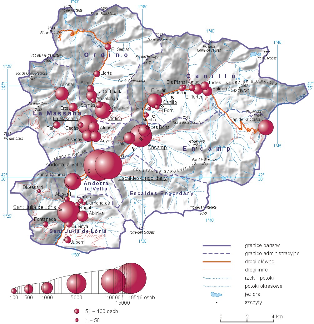
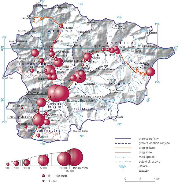
Description: Liczba ludności w miejscowościach Andory w 2013 roku (przykład mapy, na której połączono metodę kartodiagramu oraz metody jakościowe)
Title: Miejscowości Andory
Credit: Prezentacja danych na mapach. in: Marek Pieniążek, Barbara Szejgiec, Maciej Zych: Graficzna prezentacja danych statystycznych. Wykresy, mapy, GIS. Warszawa: Główny Urząd Statystyczny, 2014 [1]
Author: Maciej Zych
Usage Terms: Creative Commons Attribution 3.0
License: CC BY 3.0
License Link: http://creativecommons.org/licenses/by/3.0
Attribution Required?: Yes
Image usage
The following page links to this image:

All content from Kiddle encyclopedia articles (including the article images and facts) can be freely used under Attribution-ShareAlike license, unless stated otherwise.