
Image: Mexico map, MX-TAM

Size of this PNG preview of this SVG file: 800 × 544 pixels. Other resolution: 320 × 218 pixels.
Original image (SVG file, nominally 1,000 × 680 pixels, file size: 267 KB)
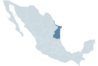
Description: Locator map for the state of Tamaulipas within Mexico.
Title: Mexico map, MX-TAM
Credit: Mexico States blank map.svg by Yavidaxiu and Sémhur
Author: Lokal_Profil
Usage Terms: Creative Commons Attribution-Share Alike 3.0
License: CC-BY-SA-3.0
License Link: http://creativecommons.org/licenses/by-sa/3.0/
Attribution Required?: Yes
Image usage
The following 3 pages link to this image:

All content from Kiddle encyclopedia articles (including the article images and facts) can be freely used under Attribution-ShareAlike license, unless stated otherwise.