
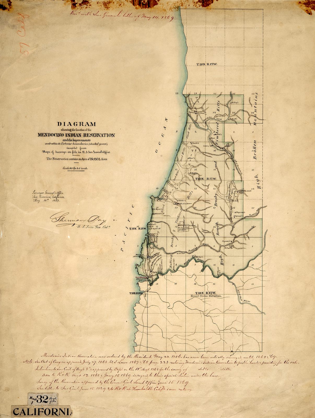
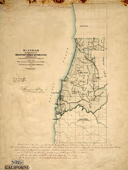
Image: Mendocino Indian Reservation
Size of this preview: 452 × 599 pixels. Other resolutions: 181 × 240 pixels | 4,861 × 6,447 pixels.
Original image (4,861 × 6,447 pixels, file size: 21.64 MB, MIME type: image/jpeg)
Description: This map was released in 1869. It represents a land survey of the Mendocino Indian Reservation which was in operation from 1856 through 1864, and was officially closed in 1866. The reservations headquarters and it's onsite military fort were located on what is now the town of Fort Bragg, California. Unlike many other reservations, the ownership of this land was retained by the federal government. In 1869 lands were put up for sale, and sold off to the (non- Indian) public for $1.25 an acre.
Title: Mendocino Indian Reservation
Credit: national archives
Author: surveyors general office
Usage Terms: Public domain
License: Public domain
Attribution Required?: No
Image usage
The following page links to this image:

All content from Kiddle encyclopedia articles (including the article images and facts) can be freely used under Attribution-ShareAlike license, unless stated otherwise.