
Image: MeigsRaidMap
No higher resolution available.
MeigsRaidMap.png (557 × 363 pixels, file size: 183 KB, MIME type: image/png)
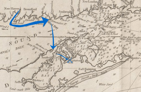
Description: A 1794 map of eastern Long Island and the Connecticut coastline, annotated to show the route of the 1777 Meigs Raid.
Title: MeigsRaidMap
Credit: Base map: Boston Public Library Digital Map Collection: http://maps.bpl.org/details_10077/ Annotations: own work
Author: Base map: Nathaniel Holland Annotations: User:Magicpiano
Usage Terms: Public domain
License: Public domain
Attribution Required?: No
Image usage
The following page links to this image:

All content from Kiddle encyclopedia articles (including the article images and facts) can be freely used under Attribution-ShareAlike license, unless stated otherwise.