
Image: MedicineLkHighlands09272017-50
Size of this JPG preview of this TIF file: 800 × 427 pixels. Other resolution: 320 × 171 pixels.
Original image (1,916 × 1,023 pixels, file size: 7.48 MB, MIME type: image/tiff)
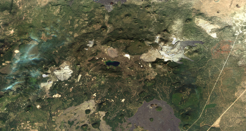
Description: Medicine Lake Volcano, California, September 27, 2017, Sentinel-2 true-color satellite image, scale 1:50,000.
Title: MedicineLkHighlands09272017-50
Credit: Own work. Sentinel-2 satellite data source: https://glovis.usgs.gov/ https://lta.cr.usgs.gov/sentinel_2 Satellite image is underlain by slope map, derived from GTOPO30 digital elevation model, source https://earthexplorer.usgs.gov/
Author: Erthygy
Usage Terms: Creative Commons Attribution-Share Alike 4.0
License: CC BY-SA 4.0
License Link: https://creativecommons.org/licenses/by-sa/4.0
Attribution Required?: Yes
Image usage
The following page links to this image:

All content from Kiddle encyclopedia articles (including the article images and facts) can be freely used under Attribution-ShareAlike license, unless stated otherwise.