
Image: Median Empire2-es

Size of this PNG preview of this SVG file: 800 × 417 pixels. Other resolution: 320 × 167 pixels.
Original image (SVG file, nominally 1,129 × 588 pixels, file size: 876 KB)
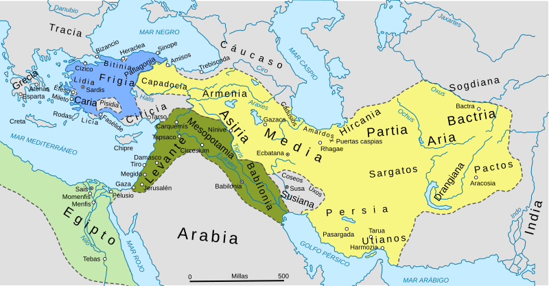
Description: Map showing the Near/Middle East in th 6th century. .mw-parser-output td.mbox-imageright{border:none;padding:2px 0.9em 2px 0;text-align:center}.mw-parser-output td.mbox-empty-cell{border:none;padding:0;width:1px} The factual accuracy of this map or the file name is disputed. Reason: NOTE: the map is based off an original map from 1920 and is likely outdated by recent research.
Title: Median Empire2-es
Credit: Median Empire.jpg ImperioAqueménida500AC.svg
Author: William Robert Shepherd
Usage Terms: Creative Commons Attribution-Share Alike 4.0
License: CC BY-SA 4.0
License Link: https://creativecommons.org/licenses/by-sa/4.0
Attribution Required?: Yes
Image usage
The following page links to this image:

All content from Kiddle encyclopedia articles (including the article images and facts) can be freely used under Attribution-ShareAlike license, unless stated otherwise.