
Image: Mdwild31c
Size of this preview: 391 × 600 pixels. Other resolutions: 156 × 240 pixels | 705 × 1,081 pixels.
Original image (705 × 1,081 pixels, file size: 161 KB, MIME type: image/jpeg)
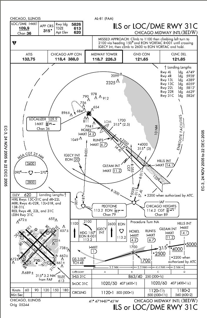
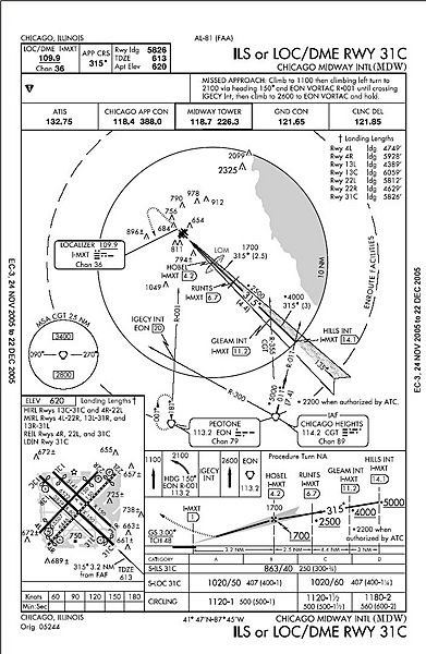
Description: ILS or LOC/DME RWY 31C approach chart. Prepared by the National Aeronautical Charting Office for the Federal Aviation Administration. Minimums listed in lower right indicate with an operating Instrument Landing System a pilot can safely descend to 863' above sea level or 250' above ground level with a runway visual range of 4,000'. No longer valid for navigation.
Title: Mdwild31c
Author: Skywayman at en.wikipedia
Usage Terms: Public domain
License: Public domain
Attribution Required?: No
Image usage
The following page links to this image:

All content from Kiddle encyclopedia articles (including the article images and facts) can be freely used under Attribution-ShareAlike license, unless stated otherwise.