
Image: Mayotte administrative1
No higher resolution available.
Mayotte_administrative1.PNG (443 × 481 pixels, file size: 19 KB, MIME type: image/png)
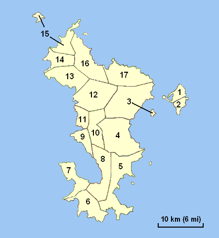
Description: Administrative map of Mayotte, with communes numbered 1 to 17: Dzaoudzi Pamandzi Mamoudzou Dembeni Bandrele Kani-Kéli Bouéni Chirongui Sada Ouangani Chiconi Tsingoni M'Tsangamouji Acoua Mtsamboro Bandraboua Koungou
Title: Mayotte administrative1
Credit: Created map myself.
Author: Godefroy
Usage Terms: Creative Commons Attribution-Share Alike 3.0
License: CC-BY-SA-3.0
License Link: http://creativecommons.org/licenses/by-sa/3.0/
Attribution Required?: Yes
Image usage
The following page links to this image:

All content from Kiddle encyclopedia articles (including the article images and facts) can be freely used under Attribution-ShareAlike license, unless stated otherwise.