
Image: Maui moku map 2
Size of this preview: 800 × 481 pixels. Other resolutions: 320 × 192 pixels | 1,536 × 923 pixels.
Original image (1,536 × 923 pixels, file size: 313 KB, MIME type: image/jpeg)
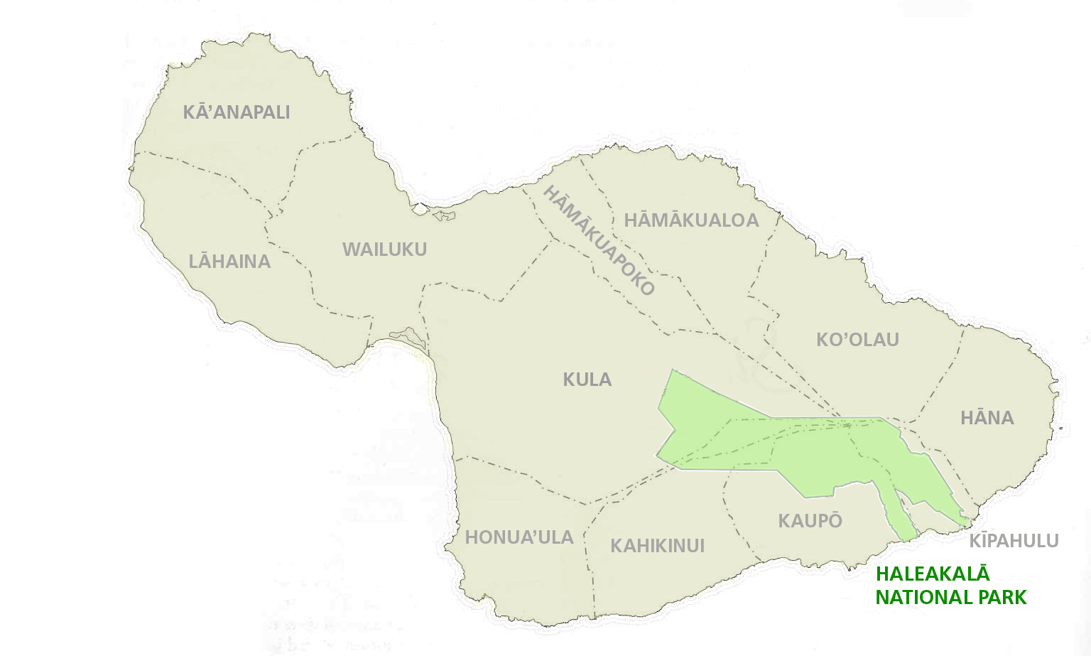
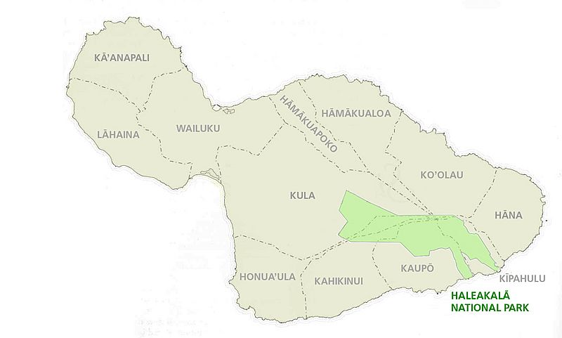
Description: map of Maui Island, Hawaii, showing traditional moku (district) division, with Haleakala National Park superimposed
Title: Maui moku map 2
Credit: http://www.nps.gov/hale/historyculture/moku.htm
Author: NPS
Usage Terms: Public domain
License: Public domain
Attribution Required?: No
Image usage
The following page links to this image:

All content from Kiddle encyclopedia articles (including the article images and facts) can be freely used under Attribution-ShareAlike license, unless stated otherwise.