
Image: Mataram 1830-en

Size of this preview: 604 × 599 pixels. Other resolutions: 242 × 240 pixels | 1,137 × 1,128 pixels.
Original image (1,137 × 1,128 pixels, file size: 58 KB, MIME type: image/png)
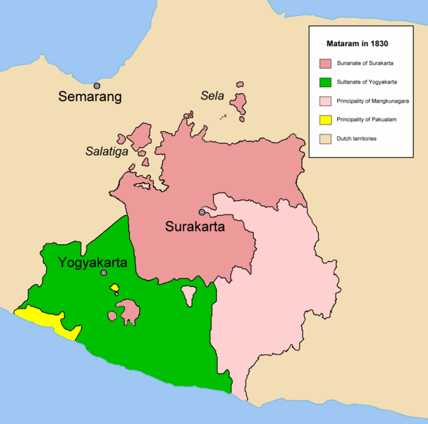
Description: Map of Neuw Mataram after the Java War in 1830. This map was drawn by Meursault2004 alias Revo Arka Giri Soekatno. Source: Robert Cribb, 2000, Historical Atlas of Indonesia page 114. en:id:Gambar:Mataram Baru 1830.png en:nl:Afbeelding:Mataram 1830-nl.png
Title: Mataram 1830-en
Credit: Transferred from en.wikipedia to Commons.
Author: Meursault2004 at English Wikipedia
Usage Terms: Creative Commons Attribution-Share Alike 3.0
License: CC-BY-SA-3.0
License Link: http://creativecommons.org/licenses/by-sa/3.0/
Attribution Required?: Yes
Image usage
The following 2 pages link to this image:

All content from Kiddle encyclopedia articles (including the article images and facts) can be freely used under Attribution-ShareAlike license, unless stated otherwise.