
Image: Marycolony
No higher resolution available.
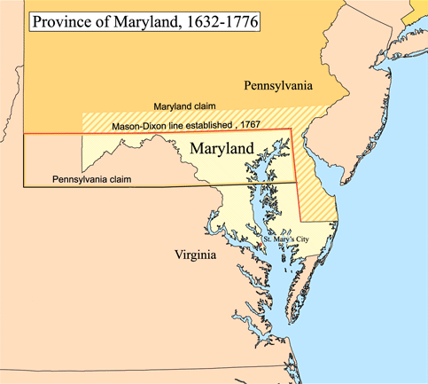
Marycolony.png (483 × 433 pixels, file size: 28 KB, MIME type: image/png)
Description: Map of the Province of Maryland. Boundary disputes between colonies not involving Maryland are not shown.
Title: Marycolony
Credit: Karl Musser
Author: Karl Musser
Usage Terms: Creative Commons Attribution-Share Alike 3.0
License: CC BY-SA 3.0
License Link: http://creativecommons.org/licenses/by-sa/3.0
Attribution Required?: Yes
Image usage
The following 5 pages link to this image:

All content from Kiddle encyclopedia articles (including the article images and facts) can be freely used under Attribution-ShareAlike license, unless stated otherwise.