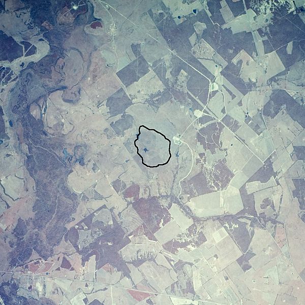
Image: Marquez dome AR5820030451618

Description: Black outline shows extent of Cretaceous rocks in the center of the Marquez Dome, which is a buried impact crater. The air photo is dated 8 March 1982. The outline is based on Geologic atlas of Texas, Waco sheet, dated 1970. Texas Highway 7 crosses diagonally at the bottom of the image and the town of Marquez lies out of the frame beyond the southeast corner. The Navasota River trends north-south along the left edge. The image is approximately 7.5 km wide.
Title: Marquez dome AR5820030451618
Credit: EarthExplorer, air photo single frame AR5820030451618
Author: James Stuby, modified from USGS air photo
Usage Terms: Creative Commons Zero, Public Domain Dedication
License: CC0
License Link: http://creativecommons.org/publicdomain/zero/1.0/deed.en
Attribution Required?: No
Image usage
The following page links to this image:

