Image: Marincellomap

Size of this preview: 800 × 530 pixels. Other resolutions: 320 × 212 pixels | 2,000 × 1,326 pixels.
Original image (2,000 × 1,326 pixels, file size: 594 KB, MIME type: image/jpeg)
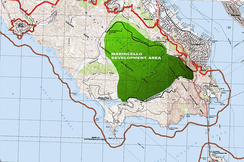
Description: The green area represents the 2,000 acres of land that was to be developed as the Marincello city. Right next to where the word AREA is written is one of the highest points of the Marin Headlands- this is where the landmark hotel would have been built. Marincello Blvd. is now the Marincello Trail. This was created on a USGS map which is public domain, and was acquired on this website: http://libremap.org/
Title: Marincellomap
Credit: Wikipedia
Author: Sportsfan919
Usage Terms: Creative Commons Attribution 3.0
License: CC BY 3.0
License Link: https://creativecommons.org/licenses/by/3.0
Attribution Required?: Yes
Image usage
The following page links to this image:

All content from Kiddle encyclopedia articles (including the article images and facts) can be freely used under Attribution-ShareAlike license, unless stated otherwise.
