
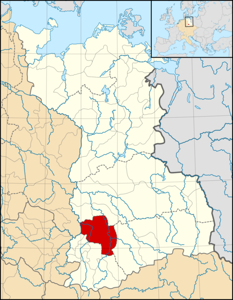
Image: March of Merseburg locator map (1004)

Description: A map of the March of Merseburg (German: Mark Merseburg) around 1004 CE. The map is derived from a vectorised version of one found in Professor G. Droysens Allgemeiner Historischer Handatlas, which was published in 1886 by R. Andrée Plate, and is now in the public domain. Note that while it uses the same scheme as standard location/locator maps, this map technically does not conform to the standard, as it is not in equirectangular projection. Therefore grid lines for latitude and longitude are included on the map.
Title: March of Merseburg locator map (1004)
Credit: Main map file: own work Data: Droysens-22-23.jpg Sub-map file: Blank map of Europe 1004.svg own work (by Alphathon), which is a derivative work of Blank map of Europe.svg by maix¿? et al.
Author: Alphathon /ˈæɫfə.θɒn/ (talk)
Usage Terms: Creative Commons Attribution-Share Alike 4.0
License: CC BY-SA 4.0
License Link: https://creativecommons.org/licenses/by-sa/4.0
Attribution Required?: Yes
Image usage
The following page links to this image:

.svg)