
Image: MappaBritanniaeFacie4
Size of this preview: 497 × 600 pixels. Other resolutions: 199 × 240 pixels | 1,400 × 1,690 pixels.
Original image (1,400 × 1,690 pixels, file size: 1.63 MB, MIME type: image/png)
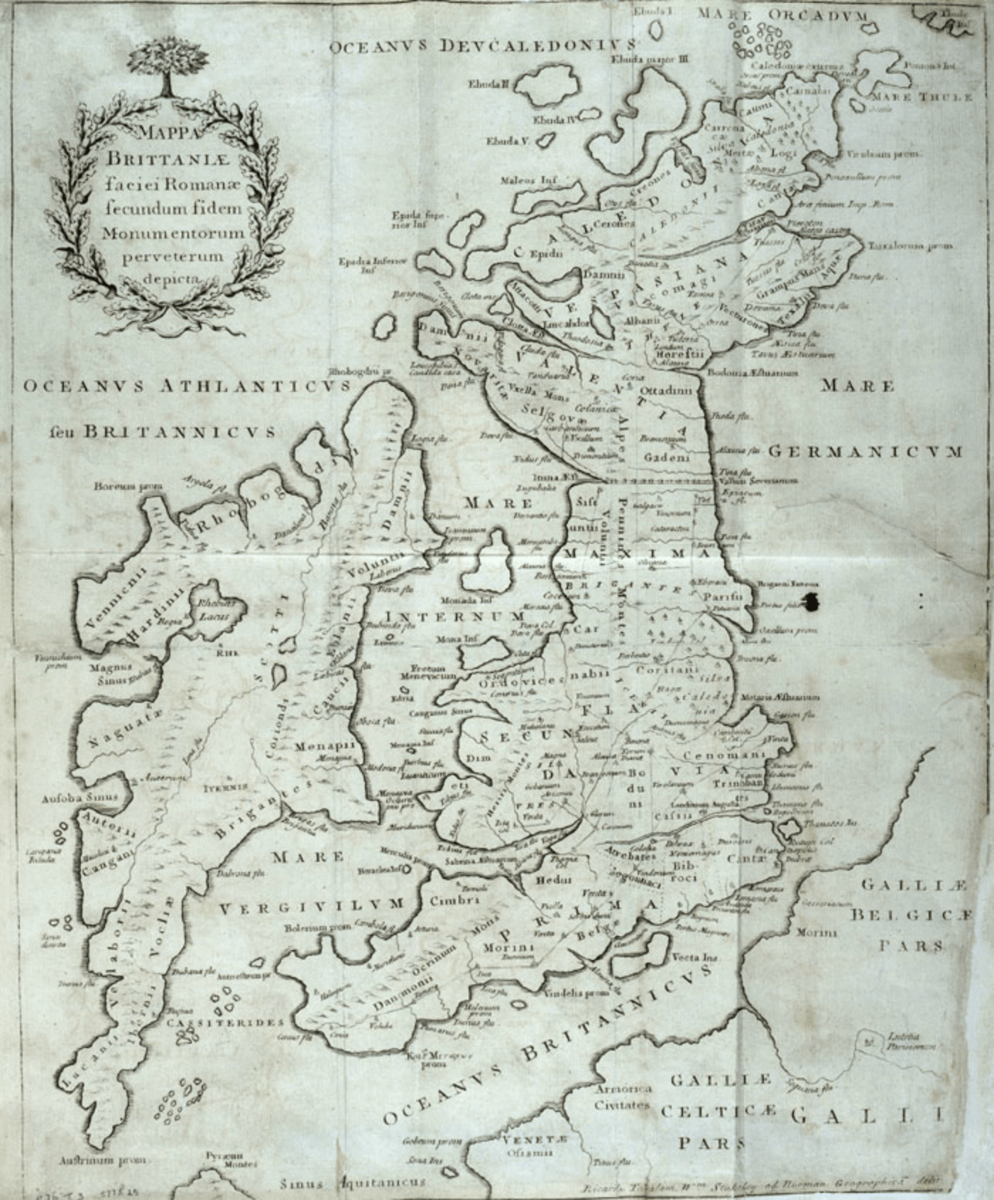
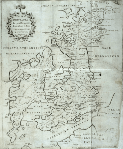
Description: A color map (440×365 mm) from William Stukeley's extracts from Charles Bertram's forged account The Description of Britain (Latin: De Situ Britanniae). →→→A historical forgery and not to be used as an accurate map.←←← Text: Mappa Britanniae faciei Romanae secundum fidem monumentorum pervertum depicta. Ricardi Tabulam Wm Stukeley ab Norman Geographica de[...?]
Title: MappaBritanniaeFacie4
Credit: William Stukeley's An Account of Richard of Cirencester, Monk of Westminster, and of his Works: with his Antient Map of Roman Brittain; and the Itinerary thereof (London: 1757).
Author: John Pettingal
Usage Terms: Public domain
License: Public domain
Attribution Required?: No
Image usage
The following page links to this image:

All content from Kiddle encyclopedia articles (including the article images and facts) can be freely used under Attribution-ShareAlike license, unless stated otherwise.