Image: Mapa relieve cordoba argentina
Mapa_relieve_cordoba_argentina.png (523 × 450 pixels, file size: 63 KB, MIME type: image/png)
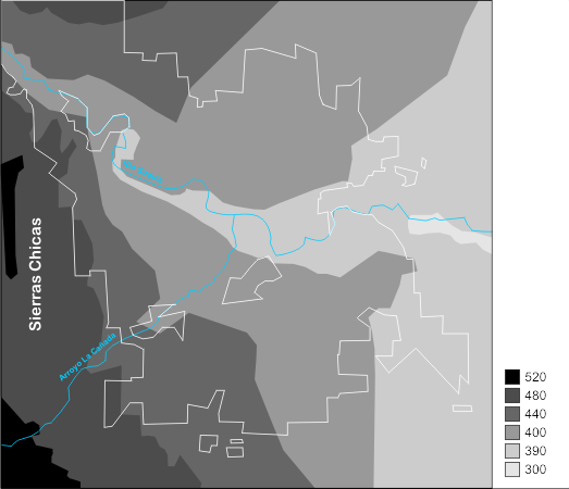
Description: Map of terrain of the City Cordoba (Argentina) with names. Scale of relief given in meters above sea level. City line indicated in white line. Main river and stream indicated in blue line.
Title: Mapa relieve cordoba argentina
Credit: Own work basado en información suministrada por el Plano de Hidrografía y Topografía de la Municipalidad de Córdoba (en formato dwf) véase: Indicadores urbanos de la ciudad de Córdoba.
Author: Leandroidecba
Usage Terms: GNU Free Documentation License
License: GFDL
License Link: http://www.gnu.org/copyleft/fdl.html
Attribution Required?: Yes
Image usage
The following page links to this image:

All content from Kiddle encyclopedia articles (including the article images and facts) can be freely used under Attribution-ShareAlike license, unless stated otherwise.

