
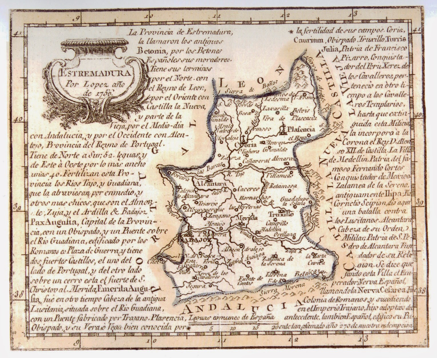
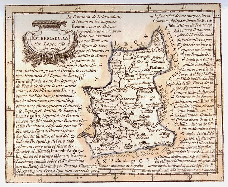
Image: Mapa de Estremadura, por Tomás López (1756)
Size of this preview: 732 × 599 pixels. Other resolutions: 293 × 240 pixels | 1,529 × 1,252 pixels.
Original image (1,529 × 1,252 pixels, file size: 1.76 MB, MIME type: image/jpeg)
Description: Map of Extremadura
Title: Mapa de Estremadura, por Tomás López (1756)
Credit: http://www.paseovirtual.net/america/#1
Author: Tomás López
Usage Terms: Public domain
License: Public domain
Attribution Required?: No
Image usage
The following page links to this image:

All content from Kiddle encyclopedia articles (including the article images and facts) can be freely used under Attribution-ShareAlike license, unless stated otherwise.
.jpg)