
Image: Map provinces Netherlands-en

Size of this PNG preview of this SVG file: 506 × 600 pixels. Other resolution: 202 × 240 pixels.
Original image (SVG file, nominally 743 × 881 pixels, file size: 987 KB)
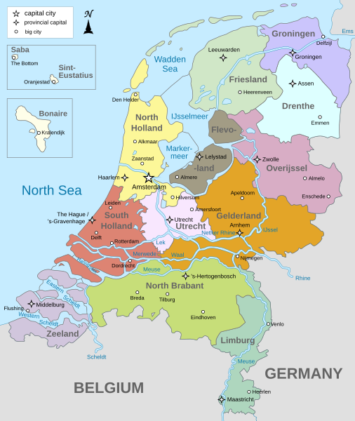
Description: Map of The Netherlands (including the special municipalities of Saba, Saint Eustatius and Bonaire; the Caribbean Netherlands), showing provinces, large cities, rivers and lakes. English version
Title: Map provinces Netherlands-en
Credit: Own work
Author: Alphathon
Usage Terms: Creative Commons Attribution-Share Alike 3.0
License: CC BY-SA 3.0
License Link: https://creativecommons.org/licenses/by-sa/3.0
Attribution Required?: Yes
Image usage
The following page links to this image:

All content from Kiddle encyclopedia articles (including the article images and facts) can be freely used under Attribution-ShareAlike license, unless stated otherwise.