
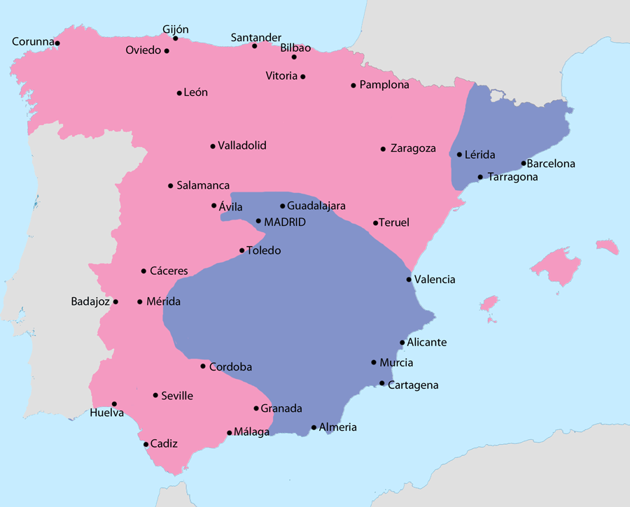
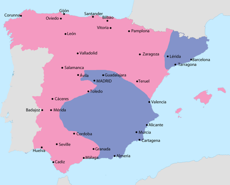
Image: Map of the Spanish Civil War in July 1938
Size of this preview: 744 × 599 pixels. Other resolutions: 298 × 240 pixels | 900 × 725 pixels.
Original image (900 × 725 pixels, file size: 48 KB, MIME type: image/png)
Description: Map showing Spain in July 1938: Area under Nationalist control (except Menorca) Area under Republican control (plus Menorca)
Title: Map of the Spanish Civil War in July 1938
Credit: File:Iberian Peninsula location map.svg
Author: NordNordWest, modifications by user:Sting, Grandiose (talk)
Usage Terms: Creative Commons Attribution-Share Alike 3.0
License: CC BY-SA 3.0
License Link: https://creativecommons.org/licenses/by-sa/3.0
Attribution Required?: Yes
Image usage
The following page links to this image:

All content from Kiddle encyclopedia articles (including the article images and facts) can be freely used under Attribution-ShareAlike license, unless stated otherwise.