
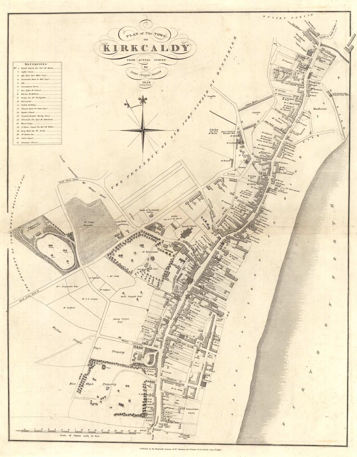
Image: Map of the Royal Burgh of Kirkcaldy 1824
Size of this preview: 469 × 600 pixels. Other resolutions: 188 × 240 pixels | 3,490 × 4,462 pixels.
Original image (3,490 × 4,462 pixels, file size: 3.59 MB, MIME type: image/jpeg)
Description: Royal Burgh of Kirkcaldy 1824 Map
Title: Map of the Royal Burgh of Kirkcaldy 1824
Credit: This image is available from the National Library of Scotland http://www.nls.uk/maps/early/towns.cfm?id=371 Transferred from en.wikipedia to Commons by User:Magnus Manske using CommonsHelper.
Author: Trustees of the National Library of Scotland
Usage Terms: Public domain
License: Public domain
Attribution Required?: No
Image usage
The following 2 pages link to this image:

All content from Kiddle encyclopedia articles (including the article images and facts) can be freely used under Attribution-ShareAlike license, unless stated otherwise.