
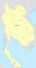
Image: Map of the Rattanakosin Kingdom

Size of this PNG preview of this SVG file: 316 × 599 pixels. Other resolution: 126 × 240 pixels.
Original image (SVG file, nominally 656 × 1,243 pixels, file size: 686 KB)
Description: Mapa del Reino de Rattanakosin
Title: Map of the Rattanakosin Kingdom
Credit: Own work David K. Wyatt: A Shot History of Thailand, 2003 The lost territories: Franco-Thai relations after WWII
Author: Milenioscuro
Permission: This file was derived from: Rivers of Southeast Asia - blank map.svg Siamese territorial concessions (1867-1909) with flags.gif
Usage Terms: Creative Commons Attribution-Share Alike 4.0
License: CC BY-SA 4.0
License Link: https://creativecommons.org/licenses/by-sa/4.0
Attribution Required?: Yes
Image usage
The following page links to this image:

All content from Kiddle encyclopedia articles (including the article images and facts) can be freely used under Attribution-ShareAlike license, unless stated otherwise.