
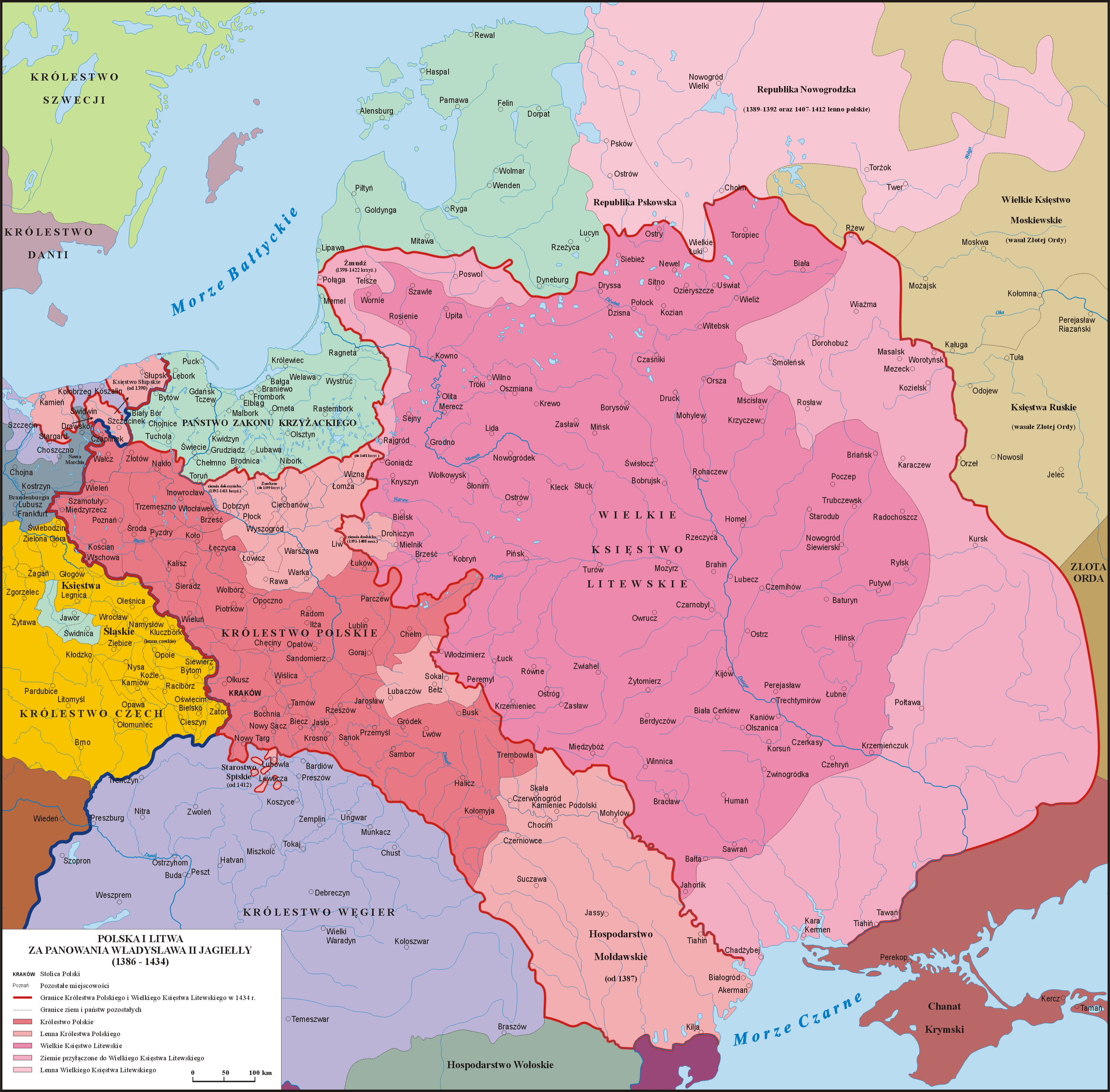
Image: Map of the Grand Duchy of Lithuania (pink) and the Crown of the Kingdom of Poland (red) in 1386 - 1434
Description: Map of the Grand Duchy of Lithuania (pink) and the Crown of the Kingdom of Poland (red) under the reign of Władysław II Jagiełło (Jogaila) in 1386 - 1434.
Title: Map of the Grand Duchy of Lithuania (pink) and the Crown of the Kingdom of Poland (red) in 1386 - 1434
Credit: Own work based on: Sienkiewicz, Witold (2006) (in Polish) Ilustrowany atlas historii Polski, Warsaw: Demart ISBN: 9788374272179. OCLC: 838949217.
Author: Poznaniak
Permission: I, the copyright holder of this work, hereby publish it under the following license:
Usage Terms: Creative Commons Attribution-Share Alike 3.0
License: CC BY-SA 3.0
License Link: https://creativecommons.org/licenses/by-sa/3.0
Attribution Required?: Yes
Image usage
The following page links to this image:

_and_the_Crown_of_the_Kingdom_of_Poland_(red)_in_1386_-_1434.png)