
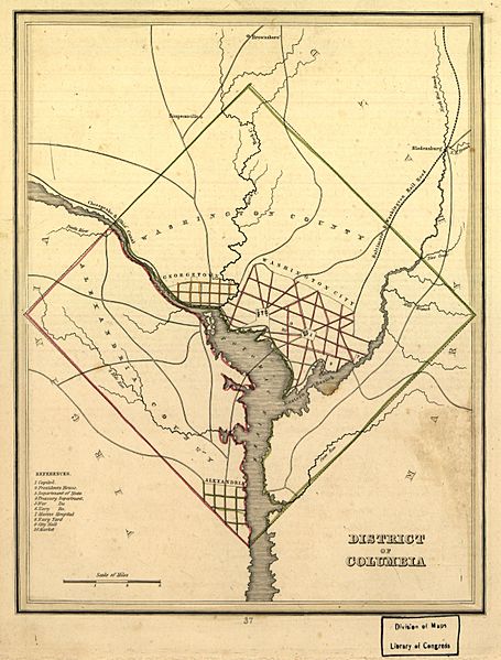
Image: Map of the District of Columbia, 1835

Size of this preview: 455 × 599 pixels. Other resolutions: 182 × 240 pixels | 2,451 × 3,226 pixels.
Original image (2,451 × 3,226 pixels, file size: 6.29 MB, MIME type: image/jpeg)
Description: 1835 map of the District of Columbia including Washington City, Georgetown, Washington County, Alexandria City, and Alexandria County. Also depicts major buildings, roads, and points of interest.
Title: Map of the District of Columbia, 1835
Credit: Library of Congress, Geography and Maps Division. Available: http://www.loc.gov/item/88694084
Author: Bradford, T. G.
Usage Terms: Public domain
License: Public domain
Attribution Required?: No
Image usage
The following 6 pages link to this image:

All content from Kiddle encyclopedia articles (including the article images and facts) can be freely used under Attribution-ShareAlike license, unless stated otherwise.