
Image: Map of sacred hills of Imerina Madagascar
Size of this preview: 800 × 517 pixels. Other resolutions: 320 × 207 pixels | 921 × 595 pixels.
Original image (921 × 595 pixels, file size: 190 KB, MIME type: image/jpeg)
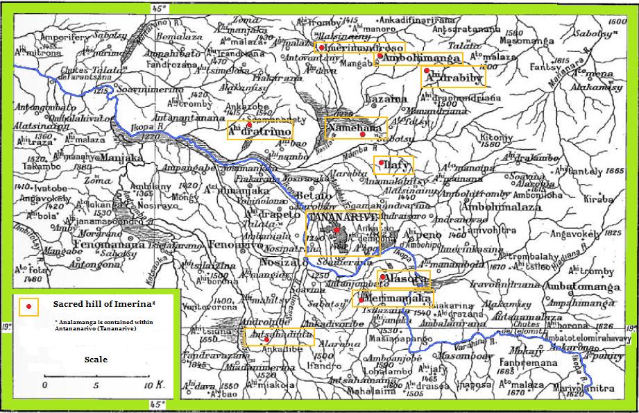
Description: Map of Imerina (around Antananarivo in the Highlands of Madagascar), showing several of the twelve sacred hills.
Title: Map of sacred hills of Imerina Madagascar
Credit: Gallica digital database of the National Library of France. Derived from image on page 17 of: Cadet & Thomas, le R. P. Madagascar, histoire et géographie élémentaires. Texte français et malgache. 2e édition. C. Poussielgue (Paris), 1901.
Author: Lemurbaby, derived from original engraving by Th. Dieudonné.
Usage Terms: Creative Commons Attribution-Share Alike 3.0
License: CC BY-SA 3.0
License Link: https://creativecommons.org/licenses/by-sa/3.0
Attribution Required?: Yes
Image usage
The following page links to this image:

All content from Kiddle encyclopedia articles (including the article images and facts) can be freely used under Attribution-ShareAlike license, unless stated otherwise.