
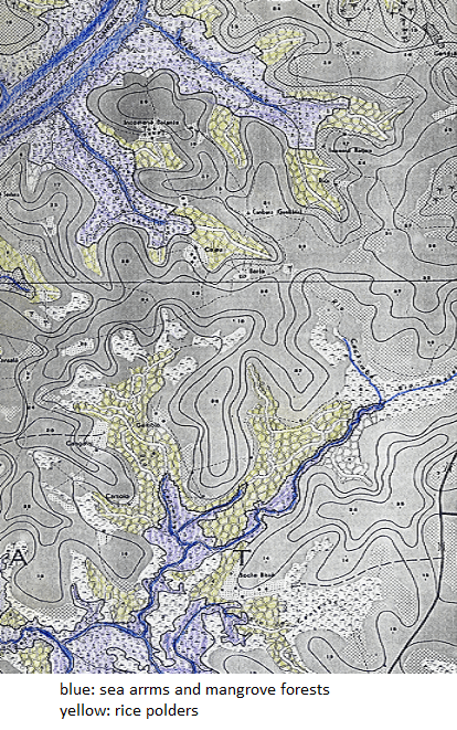
Image: Map of rice polders
Size of this preview: 375 × 599 pixels. Other resolutions: 150 × 240 pixels | 414 × 661 pixels.
Original image (414 × 661 pixels, file size: 676 KB, MIME type: image/png)
Description: Rice polders amidst the mangroves along the sea arms in the coastal area of Guinea Bissau
Title: Map of rice polders
Credit: Own work
Author: Water and Land
Usage Terms: Creative Commons Attribution-Share Alike 4.0
License: CC BY-SA 4.0
License Link: https://creativecommons.org/licenses/by-sa/4.0
Attribution Required?: Yes
Image usage
The following 2 pages link to this image:

All content from Kiddle encyclopedia articles (including the article images and facts) can be freely used under Attribution-ShareAlike license, unless stated otherwise.