
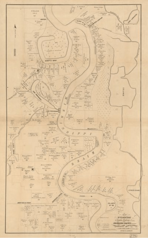
Image: Map of plantations in Carrol Parish, Louisiana and Issaquena County MS
Size of this preview: 375 × 600 pixels. Other resolutions: 150 × 240 pixels | 615 × 984 pixels.
Original image (615 × 984 pixels, file size: 389 KB, MIME type: image/png)
Description: Map of plantations in Carrol Parish, Louisiana and Issaquena County MS
Title: Map of plantations in Carrol Parish, Louisiana and Issaquena County MS
Credit: Library of Congress Geography and Maps Division
Author: A. McFarland
Usage Terms: Public domain
License: Public domain
Attribution Required?: No
Image usage
The following page links to this image:

All content from Kiddle encyclopedia articles (including the article images and facts) can be freely used under Attribution-ShareAlike license, unless stated otherwise.