
Image: Map of Ultras

Size of this preview: 800 × 489 pixels. Other resolutions: 320 × 196 pixels | 1,110 × 679 pixels.
Original image (1,110 × 679 pixels, file size: 299 KB, MIME type: image/png)
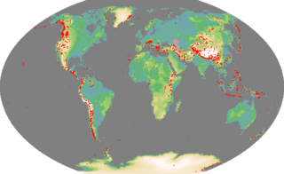
Description: Map of ultra prominences
Title: Map of Ultras
Credit: Self-made. I generated the base map using code I wrote to process the GTOPO30 data. The coastline was taken from the GSSHS coastline data bundled with GMT. The list of mountain peaks was ultimately derived from a list created by Jonathan de Ferranti from SRTM data, and which is not copyright. The degree-minute-second co-ordinates were converted into the Winkel-Tripel projection used in this map using code I wrote myself.
Author: Ras52
Usage Terms: Creative Commons Attribution 2.5
License: CC BY 2.5
License Link: https://creativecommons.org/licenses/by/2.5
Attribution Required?: Yes
Image usage
The following page links to this image:

All content from Kiddle encyclopedia articles (including the article images and facts) can be freely used under Attribution-ShareAlike license, unless stated otherwise.