
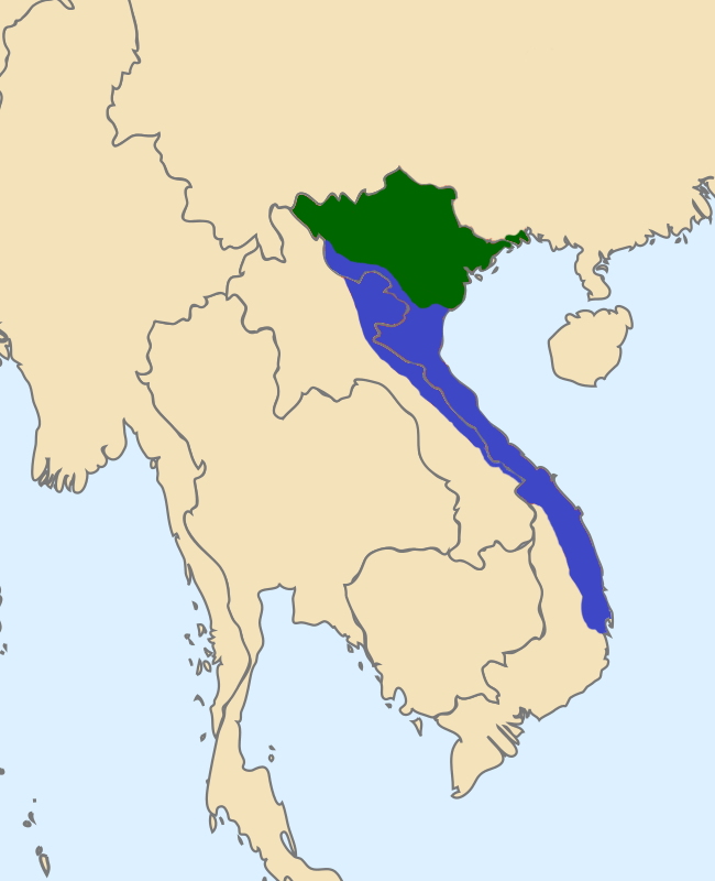
Image: Map of Southern and Northern Dynasties of Vietnam
Size of this preview: 487 × 599 pixels. Other resolutions: 195 × 240 pixels | 650 × 800 pixels.
Original image (650 × 800 pixels, file size: 124 KB, MIME type: image/png)
Description: Vietnam circa 1570 showing the Mac in control of the land north of the Red river, and the Nguyen-Trinh alliance in control of the southern part of Vietnam. Map data based on "The Empire of Le Thanh-tong" (from Jonh Whitmore's "The Development of Le Government"; and map found in "Les frontieres du Vietnam"; P.B. Lafont, Edition l’Harmattan, Paris 1989; and maps found in DK Atlas of World History.
Title: Map of Southern and Northern Dynasties of Vietnam
Credit: Own work
Author: TRMC
Usage Terms: Creative Commons Attribution-Share Alike 4.0
License: CC BY-SA 4.0
License Link: https://creativecommons.org/licenses/by-sa/4.0
Attribution Required?: Yes
Image usage
The following 3 pages link to this image:

All content from Kiddle encyclopedia articles (including the article images and facts) can be freely used under Attribution-ShareAlike license, unless stated otherwise.