
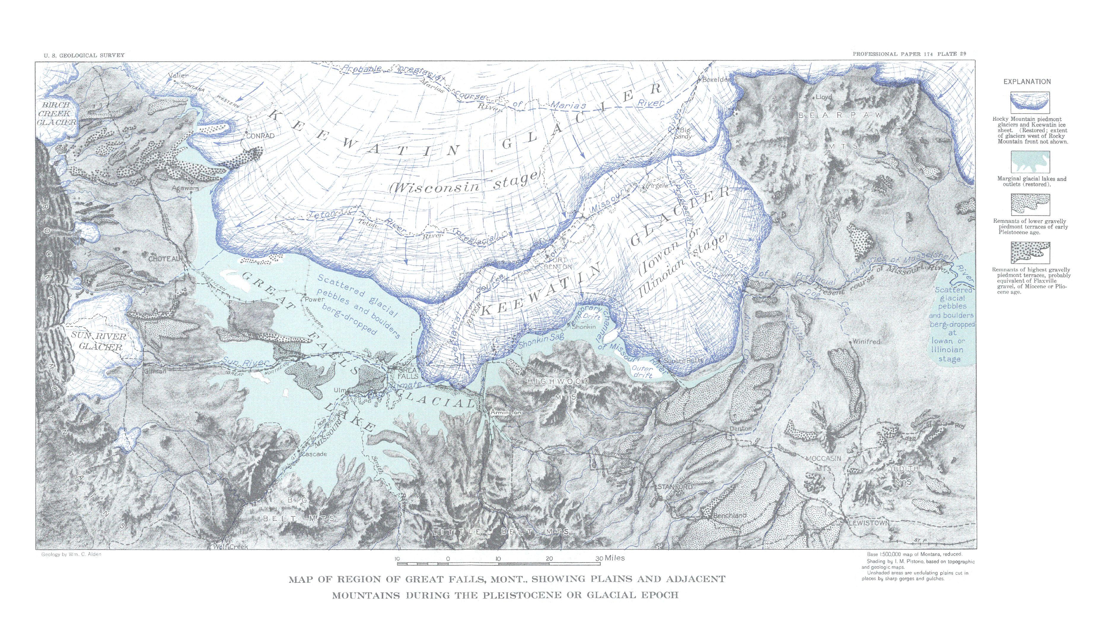
Image: Map of Region of Great Falls, Montana (pg 88)
Size of this preview: 800 × 459 pixels. Other resolutions: 320 × 184 pixels | 3,746 × 2,149 pixels.
Original image (3,746 × 2,149 pixels, file size: 1.77 MB, MIME type: image/jpeg)
Description: Map of Region of Great Falls, Montana (pg 88)
Title: Map of Region of Great Falls, Montana (pg 88)
Credit: William C. Alden; Physiography and Glacial Geology of Eastern Montana and Adjacent Areas, Professional Paper 174; Geological Survey, W. C. Mendenhall, Director; United States Department of the Interior, Ray Lyman Wilbur, Secretary; United States; Government Printing Office; Washington, D.C.; 1932
Author: William C. Alden
Usage Terms: Public domain
License: Public domain
Attribution Required?: No
Image usage
The following page links to this image:

All content from Kiddle encyclopedia articles (including the article images and facts) can be freely used under Attribution-ShareAlike license, unless stated otherwise.
.jpg)