
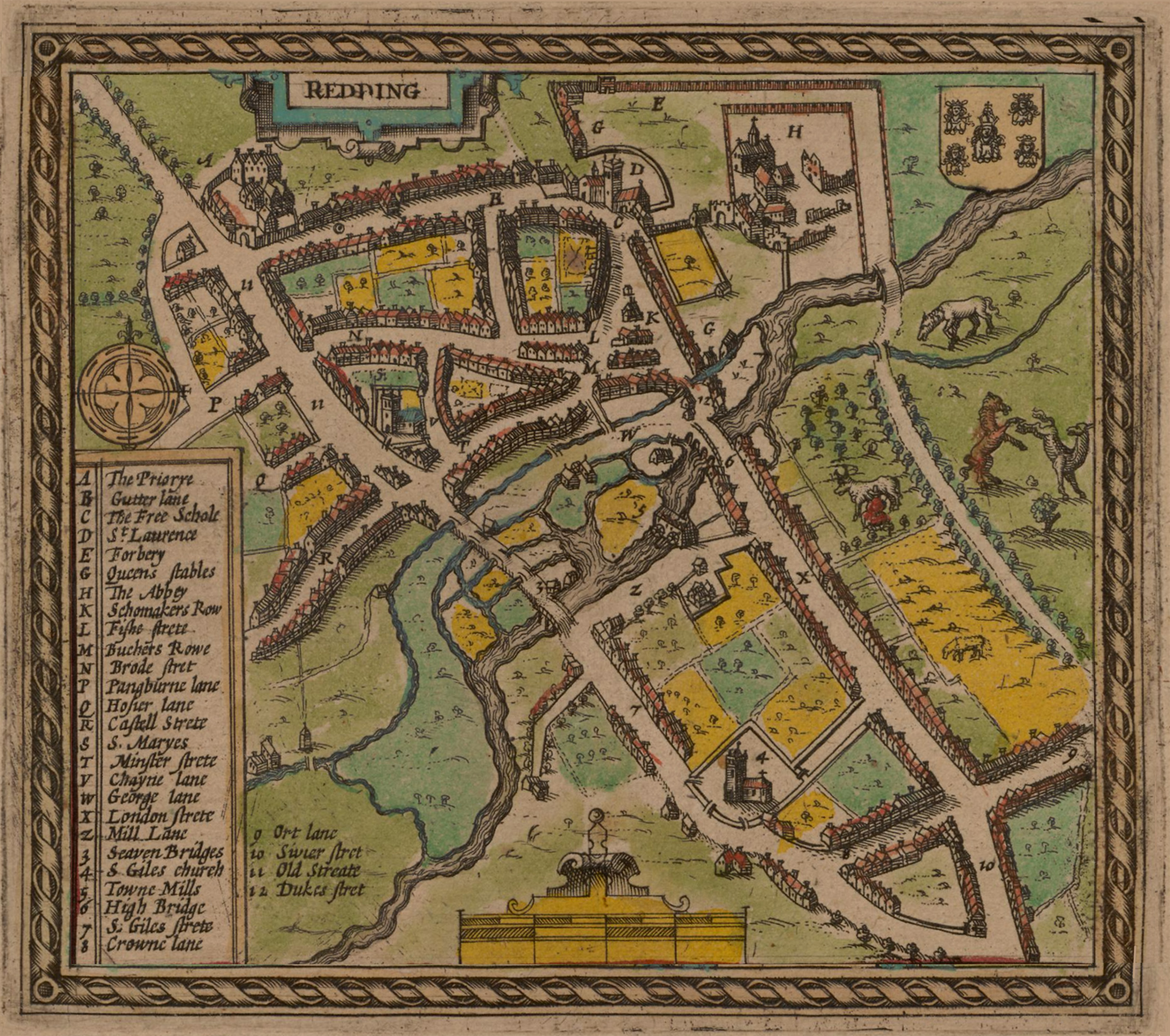
Image: Map of Redding by John Speed, 1611
Size of this preview: 677 × 599 pixels. Other resolutions: 271 × 240 pixels | 3,163 × 2,800 pixels.
Original image (3,163 × 2,800 pixels, file size: 2.13 MB, MIME type: image/jpeg)
Description: Upper-right detail from the map of Buckingham, showing the earliest map of Reading, published in John Speed's atlas of Great Britain, 1611.
Title: Map of Redding by John Speed, 1611
Credit: Detail from the map Buckinghamshire Former upload was scanned from: The Story of Reading. Countryside Books. p. 43. ISBN 0-905392-07-8.
Author: John Speed
Usage Terms: Public domain
License: Public domain
Attribution Required?: No
Image usage
The following 4 pages link to this image:

All content from Kiddle encyclopedia articles (including the article images and facts) can be freely used under Attribution-ShareAlike license, unless stated otherwise.