
Image: Map of Portuguese India

Size of this preview: 730 × 600 pixels. Other resolutions: 292 × 240 pixels | 1,709 × 1,404 pixels.
Original image (1,709 × 1,404 pixels, file size: 467 KB, MIME type: image/png)
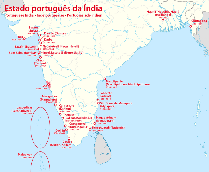
Description: Map of Portuguese India
Title: Map of Portuguese India
Credit: Own work, using this map by Uwe Dedering The data is from the German Wikipedia page about the Portuguese Empire
Author: Maximilian Dörrbecker (Chumwa)
Permission: I, the copyright holder of this work, hereby publish it under the following license:
Usage Terms: Creative Commons Attribution-Share Alike 2.5
License: CC BY-SA 2.5
License Link: https://creativecommons.org/licenses/by-sa/2.5
Attribution Required?: Yes
Image usage
The following 2 pages link to this image:

All content from Kiddle encyclopedia articles (including the article images and facts) can be freely used under Attribution-ShareAlike license, unless stated otherwise.