
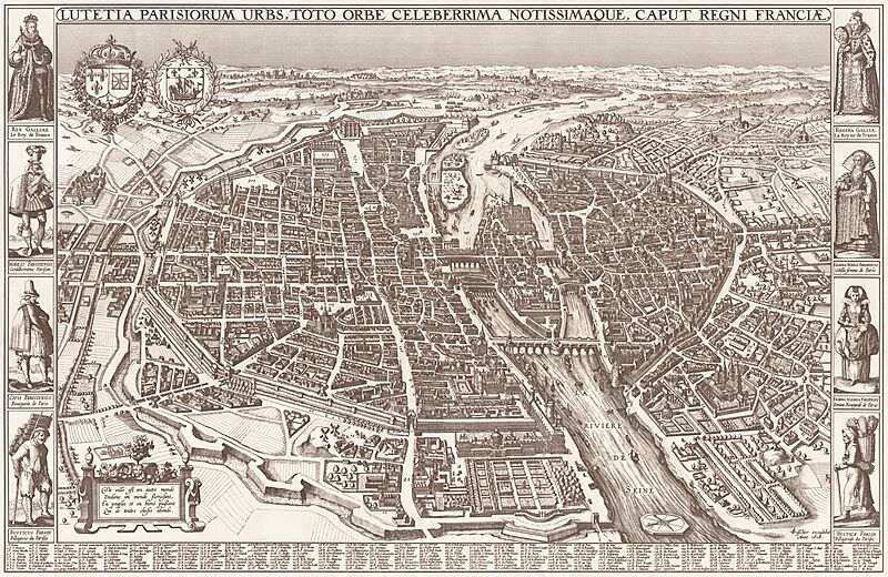
Image: Map of Paris by Claes Jansz. Visscher - Harold B. Lee Library

Size of this preview: 800 × 520 pixels. Other resolutions: 320 × 208 pixels | 20,207 × 13,139 pixels.
Original image (20,207 × 13,139 pixels, file size: 43.36 MB, MIME type: image/jpeg)
Description: Map of the city of Paris. Scale: ca. 1:2.000.
Title: Lutetia Parisorum urbs, toto orbe celeberrima notissimaque, caput regni Franciae.
Credit: Harold B. Lee Library Maps Collection
Author: Claes Janszoon Visscher II
Usage Terms: Public domain
License: Public domain
Attribution Required?: No
Image usage
The following page links to this image:

All content from Kiddle encyclopedia articles (including the article images and facts) can be freely used under Attribution-ShareAlike license, unless stated otherwise.