
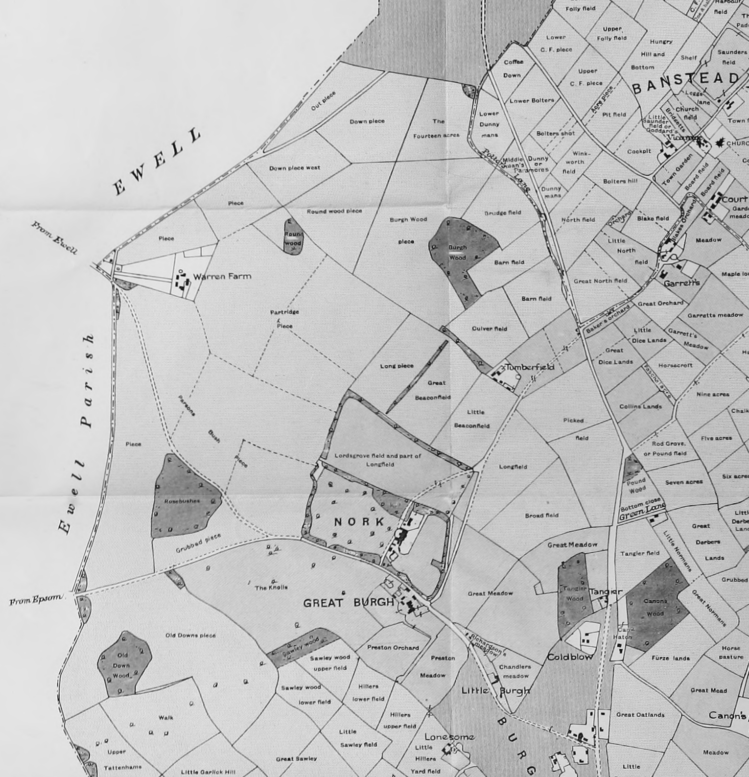
Image: Map of Nork 1841 Lambert
Size of this preview: 578 × 600 pixels. Other resolutions: 231 × 240 pixels | 1,530 × 1,587 pixels.
Original image (1,530 × 1,587 pixels, file size: 1.51 MB, MIME type: image/png)
Description: Part of a map in Lambert, H.C.M. 1912 History of Banstead in Surrey, based on a tithe map of 1841. This section shows much of what is present-day Nork. The map must be twisted 25° clockwise to point north. The width is 2.7 km.
Title: Map of Nork 1841 Lambert
Credit: https://openlibrary.org/books/OL23304266M/History_of_Banstead_in_Surrey.
Author: H.C.M. Lambert
Usage Terms: Public domain
License: Public domain
Attribution Required?: No
Image usage
The following page links to this image:

All content from Kiddle encyclopedia articles (including the article images and facts) can be freely used under Attribution-ShareAlike license, unless stated otherwise.