
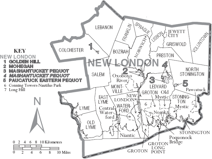
Image: Map of New London County Connecticut With Municipal Labels
No higher resolution available.
Map_of_New_London_County_Connecticut_With_Municipal_Labels.PNG (678 × 510 pixels, file size: 78 KB, MIME type: image/png)
Description: Map of New London County, Connecticut, United States with township and municipal boundaries
Title: Map of New London County Connecticut With Municipal Labels
Credit: Taken from the US Census website(click here to view the exact location on their site) and modified and slightly rearranged by User:Kotosb
Author: United States Census Bureau employee
Permission: No copyrighted material was used. some government material was used here
Usage Terms: Public domain
License: PD
Attribution Required?: No
Image usage
The following 2 pages link to this image:

All content from Kiddle encyclopedia articles (including the article images and facts) can be freely used under Attribution-ShareAlike license, unless stated otherwise.