
Image: Map of Meridian Line set under the Treaty of Tordesillas
Size of this preview: 800 × 573 pixels. Other resolutions: 320 × 229 pixels | 990 × 709 pixels.
Original image (990 × 709 pixels, file size: 141 KB, MIME type: image/jpeg)
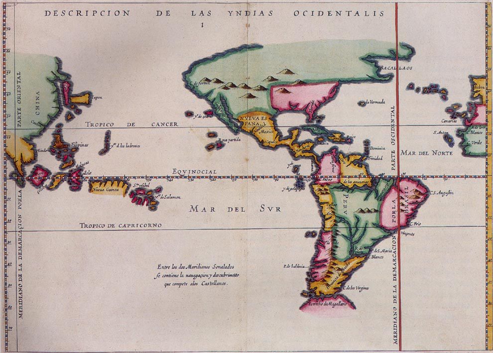
Description: Map by Spanish chronicler, historian, and writer, Antonio de Herrera y Tordesillas (1548–1625) showing the meridian established under the 1494 Treaty of Tordesillas to define land entitlements between Spain and Portugal.
Title: Map of Meridian Line set under the Treaty of Tordesillas
Credit: https://www.nationalgeographic.org/thisday/jun7/treaty-tordesillas/
Author: Map by Antonio de Herrera y Tordesillas
Usage Terms: Public domain
License: Public domain
Attribution Required?: No
Image usage
The following page links to this image:

All content from Kiddle encyclopedia articles (including the article images and facts) can be freely used under Attribution-ShareAlike license, unless stated otherwise.