
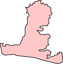
Image: Map of Hayling Island, England
No higher resolution available.
Map_of_Hayling_Island,_England.png (256 × 261 pixels, file size: 5 KB, MIME type: image/png)
Description: Map showing the costal outline of Hayling Island, England. Created 2005/03/12 by Ben Wheatley.
Title: Map of Hayling Island, England
Credit: Whitepaw (talk) (Uploads)
Author: Whitepaw (talk) (Uploads)
Usage Terms: Public domain
License: Public domain
Attribution Required?: No
Image usage
The following page links to this image:

All content from Kiddle encyclopedia articles (including the article images and facts) can be freely used under Attribution-ShareAlike license, unless stated otherwise.