
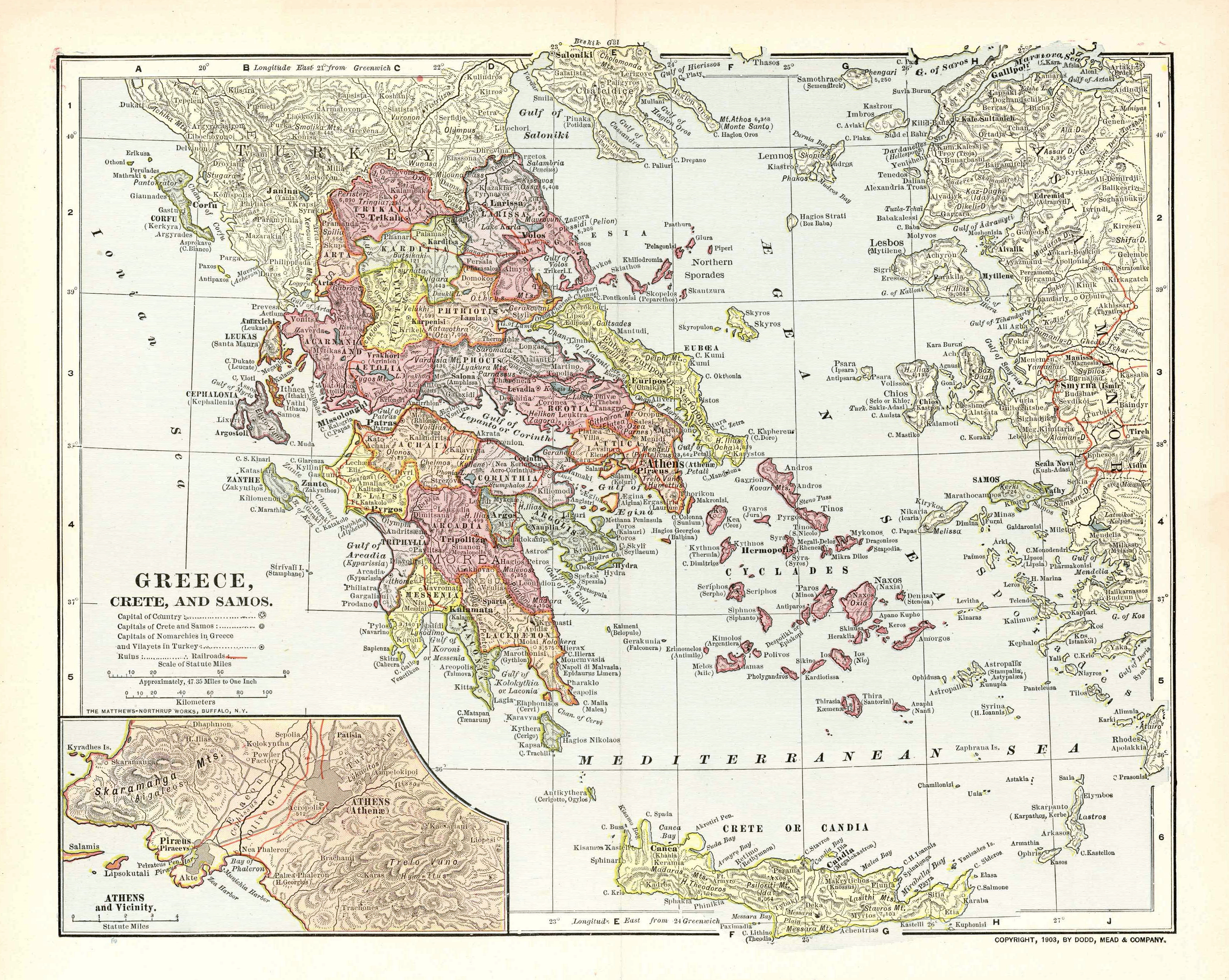
Image: Map of Greece 1903
Size of this preview: 752 × 600 pixels. Other resolutions: 301 × 240 pixels | 3,472 × 2,768 pixels.
Original image (3,472 × 2,768 pixels, file size: 6.37 MB, MIME type: image/png)
Description: Map of the Kingdom of Greece, the Cretan State and the Principality of Samos in 1903. It displays the greek railway network as it was in 1900-1901.
Title: Map of Greece 1903
Credit: Old map, own collection.
Author: Unknown. Published by Dodd, Mead & Co. Printed by Mattheus-Northup Works, Buffalo, NY.
Usage Terms: Public domain in the United States
License: PD-US
License Link: //en.wikipedia.org/wiki/File:Map_of_Greece_1903.png
Image usage
The following page links to this image:

All content from Kiddle encyclopedia articles (including the article images and facts) can be freely used under Attribution-ShareAlike license, unless stated otherwise.