
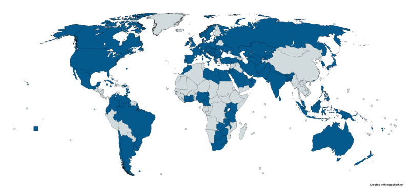
Image: Map of Countries visited by King Charles III on an official overseas visit

Size of this preview: 800 × 369 pixels. Other resolutions: 320 × 148 pixels | 7,192 × 3,318 pixels.
Original image (7,192 × 3,318 pixels, file size: 674 KB, MIME type: image/png)
Description: Map of Countries visited by King Charles III on an official overseas visit
Title: Map of Countries visited by King Charles III on an official overseas visit
Credit: Own work
Author: Wiki5678902
Usage Terms: Creative Commons Attribution-Share Alike 4.0
License: CC BY-SA 4.0
License Link: https://creativecommons.org/licenses/by-sa/4.0
Attribution Required?: Yes
Image usage
The following page links to this image:

All content from Kiddle encyclopedia articles (including the article images and facts) can be freely used under Attribution-ShareAlike license, unless stated otherwise.