
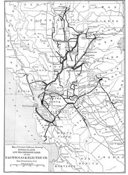
Image: Map of Central California Showing Power Plants and Transmission Lines of the Pacific Gas and Electric Company c 1912

Size of this preview: 440 × 599 pixels. Other resolutions: 176 × 240 pixels | 1,394 × 1,898 pixels.
Original image (1,394 × 1,898 pixels, file size: 1.24 MB, MIME type: image/png)
Description: Map of Central California Showing Power Plants and Transmission Lines of the Pacific Gas and Electric Company c 1912
Title: Map of Central California Showing Power Plants and Transmission Lines of the Pacific Gas and Electric Company c 1912
Credit: McGraw Electric Railway Manual: Issued Annually in Connection with the Electric Railway Journal: 1912 http://hdl.handle.net/2027/mdp.39015089293073 - HathiTrust Google Digitized
Author: McGraw Electric Railway Manual
Usage Terms: Public domain
License: Public domain
Attribution Required?: No
Image usage
The following page links to this image:

All content from Kiddle encyclopedia articles (including the article images and facts) can be freely used under Attribution-ShareAlike license, unless stated otherwise.