
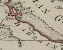
Image: Map of Catura (Qatar) 1794 (cropped)
No higher resolution available.
Map_of_Catura_(Qatar)_1794_(cropped).jpg (259 × 203 pixels, file size: 20 KB, MIME type: image/jpeg)
Description: A map, “Arabia According to Its Modern Divisions”, made by Samuel Dunn in 1794 which shows the Arabian Peninsula, the Persian Gulf and Iran.
Title: Map of Catura (Qatar) 1794 (cropped)
Credit: Qatar Digital Library
Author: Samuel Dunn, Qatar National Library
Usage Terms: Creative Commons Attribution-Share Alike 4.0
License: CC BY-SA 4.0
License Link: https://creativecommons.org/licenses/by-sa/4.0
Attribution Required?: Yes
Image usage
The following page links to this image:

All content from Kiddle encyclopedia articles (including the article images and facts) can be freely used under Attribution-ShareAlike license, unless stated otherwise.
_1794_(cropped).jpg)