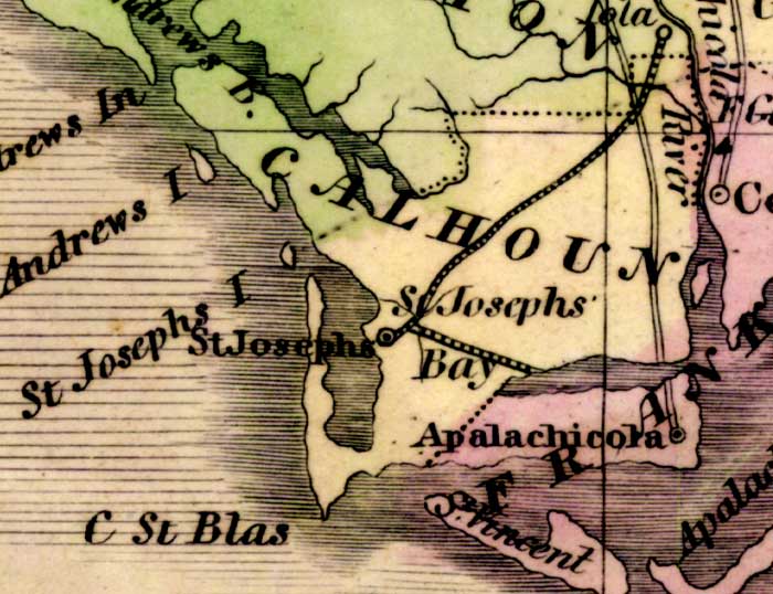
Image: Map of Calhoun County, Florida in 1842
Map_of_Calhoun_County,_Florida_in_1842.jpg (700 × 538 pixels, file size: 67 KB, MIME type: image/jpeg)
Description: Map of Calhoun County, Florida in 1842. The map shows the county seat, St. Joseph, Apalachicola (in Franklin County), and the rail lines of the Lake Wimico and St. Joseph Railroad, running from St. Joseph to Lake Wimico (which is unlabeled) and from St. Joseph to the Apalachicola River at Iola (in Washington County)
Title: Map of Calhoun County, Florida in 1842
Credit: Maps ETC Florida Center for Educational Technology University of South Florida
Author: Jeremiah Greenleaf, A New Universal Atlas, Brattleboro, Vermont, 1842
Usage Terms: Public domain
License: Public domain
Attribution Required?: No
Image usage
The following 2 pages link to this image:

All content from Kiddle encyclopedia articles (including the article images and facts) can be freely used under Attribution-ShareAlike license, unless stated otherwise.

