
Image: Map of 2021 Cumbre Vieja eruption
Size of this preview: 457 × 599 pixels. Other resolutions: 183 × 240 pixels | 715 × 937 pixels.
Original image (715 × 937 pixels, file size: 260 KB, MIME type: image/png)
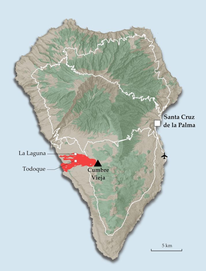
Description: Map describing the 2021 Cumbre Vieja volcanic eruption, with location of the volcano shown together with the range of lava coverage (as of 23/11/2021), the capital city, airport and location of centres of destroyed localities of Todoque and La Laguna
Title: Map of 2021 Cumbre Vieja eruption
Credit: Own work
Author: Jakub Kaczorowski
Usage Terms: Creative Commons Attribution-Share Alike 4.0
License: CC BY-SA 4.0
License Link: https://creativecommons.org/licenses/by-sa/4.0
Attribution Required?: Yes
Image usage
The following 2 pages link to this image:

All content from Kiddle encyclopedia articles (including the article images and facts) can be freely used under Attribution-ShareAlike license, unless stated otherwise.