
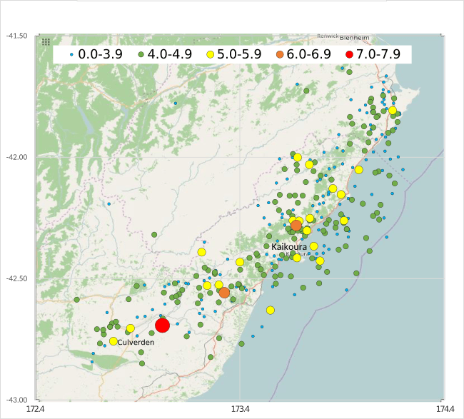
Image: Map of 2016 Kaikoura earthquake

Size of this PNG preview of this SVG file: 650 × 588 pixels. Other resolution: 265 × 240 pixels.
Original image (SVG file, nominally 650 × 588 pixels, file size: 934 KB)
Description: Map of 2016 Kaikoura earthquake, with epicentres in Culverden and Kaikoura, east cost of New Zealand South island.
Title: Map of 2016 Kaikoura earthquake
Credit: Own work Data source:GeoNet
Author: Phoenix7777
Usage Terms: Creative Commons Attribution-Share Alike 4.0
License: CC BY-SA 4.0
License Link: http://creativecommons.org/licenses/by-sa/4.0
Attribution Required?: Yes
Image usage
The following 2 pages link to this image:

All content from Kiddle encyclopedia articles (including the article images and facts) can be freely used under Attribution-ShareAlike license, unless stated otherwise.