
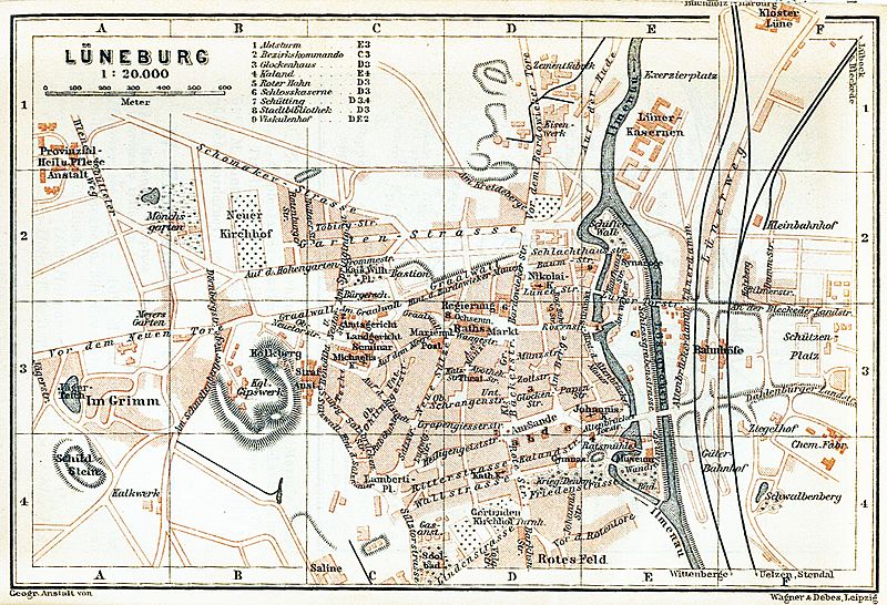
Image: Map luneburg 1910

Size of this preview: 800 × 546 pixels. Other resolutions: 320 × 218 pixels | 1,173 × 800 pixels.
Original image (1,173 × 800 pixels, file size: 621 KB, MIME type: image/jpeg)
Description: Town map of Lüneburg, Germany, 1910
Title: Map luneburg 1910
Credit: http://www.lib.utexas.edu/maps/historical/baedeker_n_germany_1910/luneburg_1910.jpg
Author: "Northern Germany as far as the Bavarian and Austrian Frontiers; Handbook for Travellers" by Karl Baedeker. Fifteenth Revised Edition. Leipzig, Karl Baedeker; New York, Charles Scribner's Sons 1910.
Permission: "Courtesy of the University of Texas Libraries, The University of Texas at Austin." http://www.lib.utexas.edu/maps/map_sites/hist_sites.html
Usage Terms: Public domain
License: Public domain
Attribution Required?: No
Image usage
The following page links to this image:

All content from Kiddle encyclopedia articles (including the article images and facts) can be freely used under Attribution-ShareAlike license, unless stated otherwise.