Image: Map eleciones restauracion

Size of this preview: 726 × 599 pixels. Other resolutions: 291 × 240 pixels | 820 × 677 pixels.
Original image (820 × 677 pixels, file size: 40 KB, MIME type: image/jpeg)
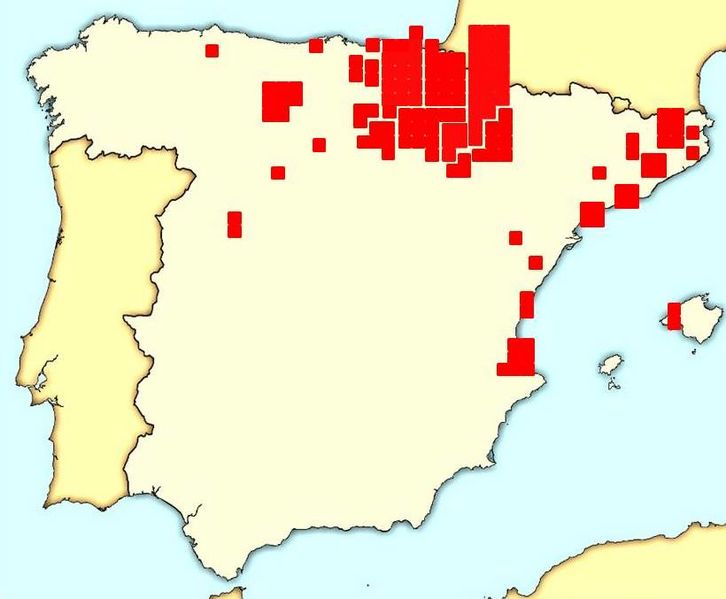
Description: Carlist deputies elected to Cortes Generales (lower house) during the Restauration period (1879-1923). Each little square represents one deputy. Each polygon represents one electoral district. source: Índice Histórico de Diputados available at www.congreso.es
Title: Map eleciones restauracion
Credit: Own work
Author: Dd1495
Usage Terms: Creative Commons Zero, Public Domain Dedication
License: CC0
License Link: http://creativecommons.org/publicdomain/zero/1.0/deed.en
Attribution Required?: No
Image usage
The following page links to this image:

All content from Kiddle encyclopedia articles (including the article images and facts) can be freely used under Attribution-ShareAlike license, unless stated otherwise.
