
Image: Map Kaan & Mutal

Size of this preview: 572 × 599 pixels. Other resolutions: 229 × 240 pixels | 1,332 × 1,395 pixels.
Original image (1,332 × 1,395 pixels, file size: 196 KB, MIME type: image/jpeg)
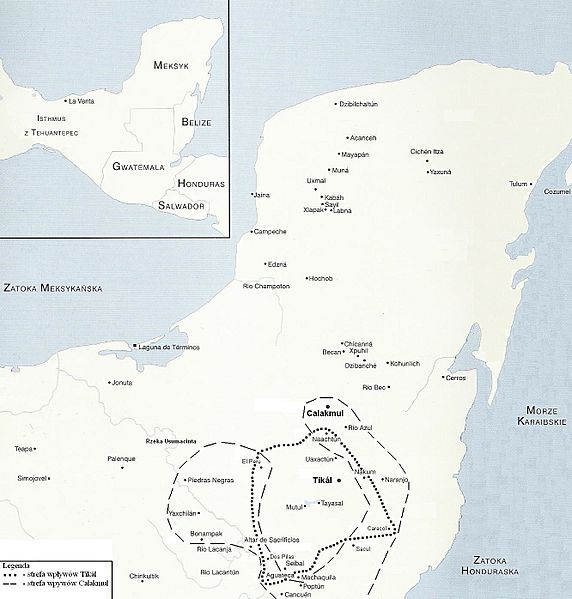
Description: The range of influence of Calakmul and Tikal during the war between these two cities between 526 and 680 AD.
Title: Map Kaan & Mutal
Credit: Own work
Author: Flack
Usage Terms: Public domain
License: Public domain
Attribution Required?: No
Image usage
The following page links to this image:

All content from Kiddle encyclopedia articles (including the article images and facts) can be freely used under Attribution-ShareAlike license, unless stated otherwise.