
Image: Map Helperknapp
No higher resolution available.
Map_Helperknapp.png (203 × 270 pixels, file size: 6 KB, MIME type: image/png)
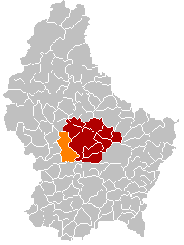
Description: Map of the municiaplity Helperknapp, Luxembourg, result of a merger of the former municipalities of Boevange/Attert and Tuntange. The merger takes effect on 2018-01-01.
Title: Map Helperknapp
Credit: Source File:Map Boevange-sur-Attert.PNG; modified colour scheme to reflect merger.
Author: User:Zinneke; User:Markussep: Uset:NordNordWest
Usage Terms: Creative Commons Zero, Public Domain Dedication
License: CC0
License Link: http://creativecommons.org/publicdomain/zero/1.0/deed.en
Attribution Required?: No
Image usage
The following page links to this image:

All content from Kiddle encyclopedia articles (including the article images and facts) can be freely used under Attribution-ShareAlike license, unless stated otherwise.