
Image: Map Gallia Tribes Towns-la

Size of this PNG preview of this SVG file: 595 × 599 pixels. Other resolution: 238 × 240 pixels.
Original image (SVG file, nominally 1,450 × 1,460 pixels, file size: 2.33 MB)
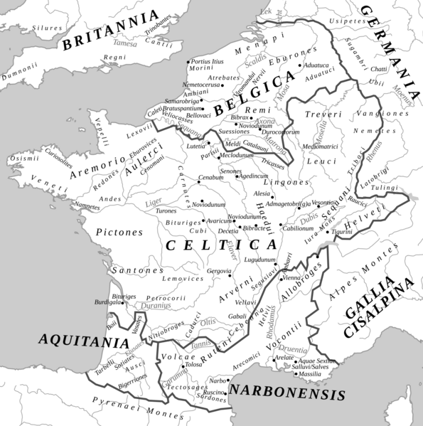
Description: Roman provinces and the Proto-basque, Celtic and Germanic peoples at the end of the 1st century BC. J-C.
Title: Map Gallia Tribes Towns-la
Credit: This file has been extracted from another file
Author: Feitscherg
Usage Terms: Creative Commons Attribution-Share Alike 3.0
License: CC BY-SA 3.0
License Link: http://creativecommons.org/licenses/by-sa/3.0/
Attribution Required?: Yes
Image usage
The following page links to this image:

All content from Kiddle encyclopedia articles (including the article images and facts) can be freely used under Attribution-ShareAlike license, unless stated otherwise.