
Image: Map Blackford County 1888
Size of this preview: 710 × 599 pixels. Other resolutions: 284 × 240 pixels | 1,238 × 1,045 pixels.
Original image (1,238 × 1,045 pixels, file size: 145 KB, MIME type: image/jpeg)
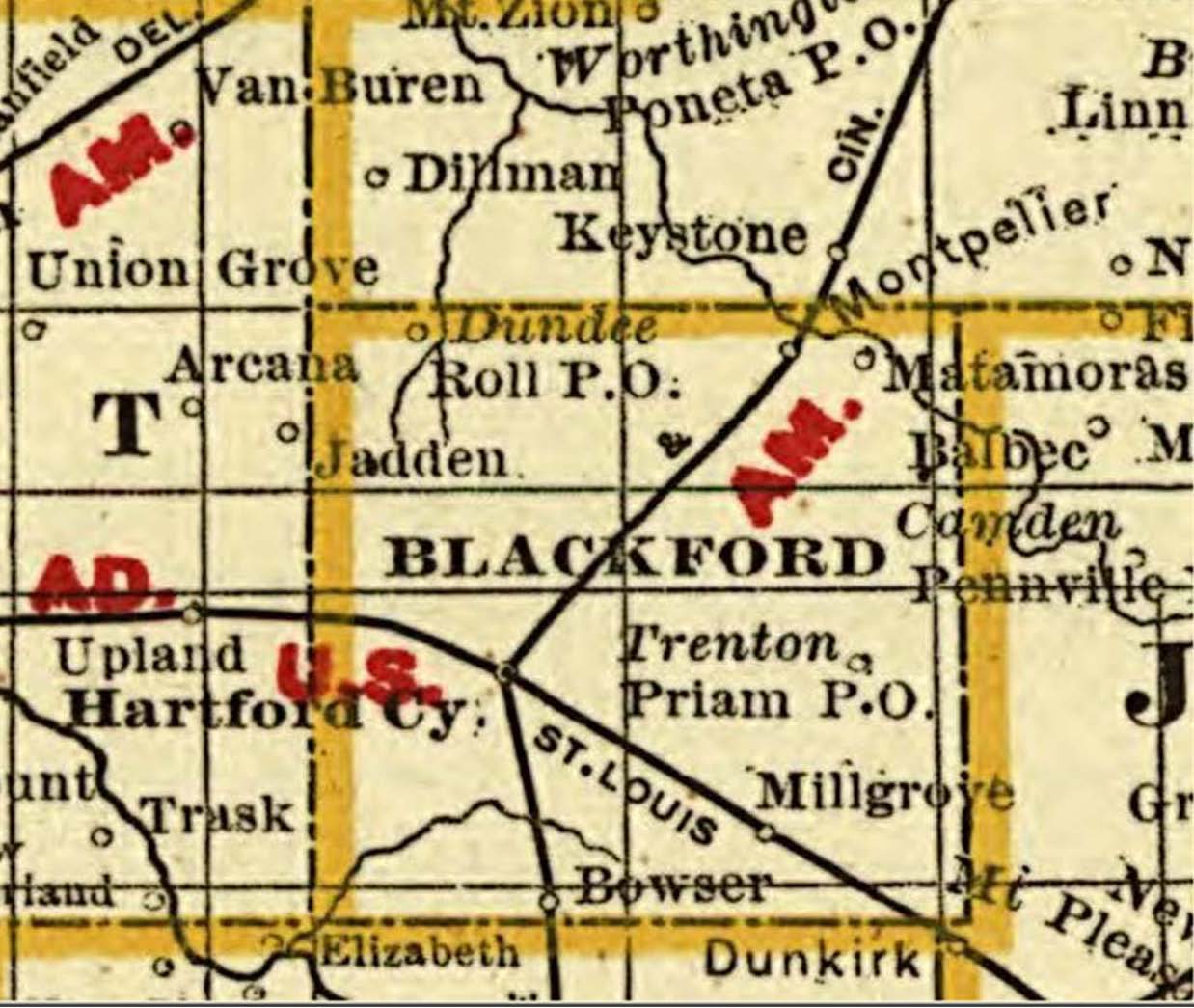
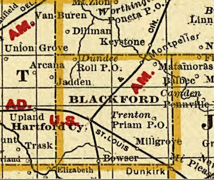
Description: Blackford County, Indiana, portion of Cram's township and rail road map of Indiana published in 1888.
Title: Map Blackford County 1888
Credit: United States Library of Congress
Author: George Franklin Cram
Usage Terms: Public domain
License: Public domain
Attribution Required?: No
Image usage
The following page links to this image:

All content from Kiddle encyclopedia articles (including the article images and facts) can be freely used under Attribution-ShareAlike license, unless stated otherwise.