
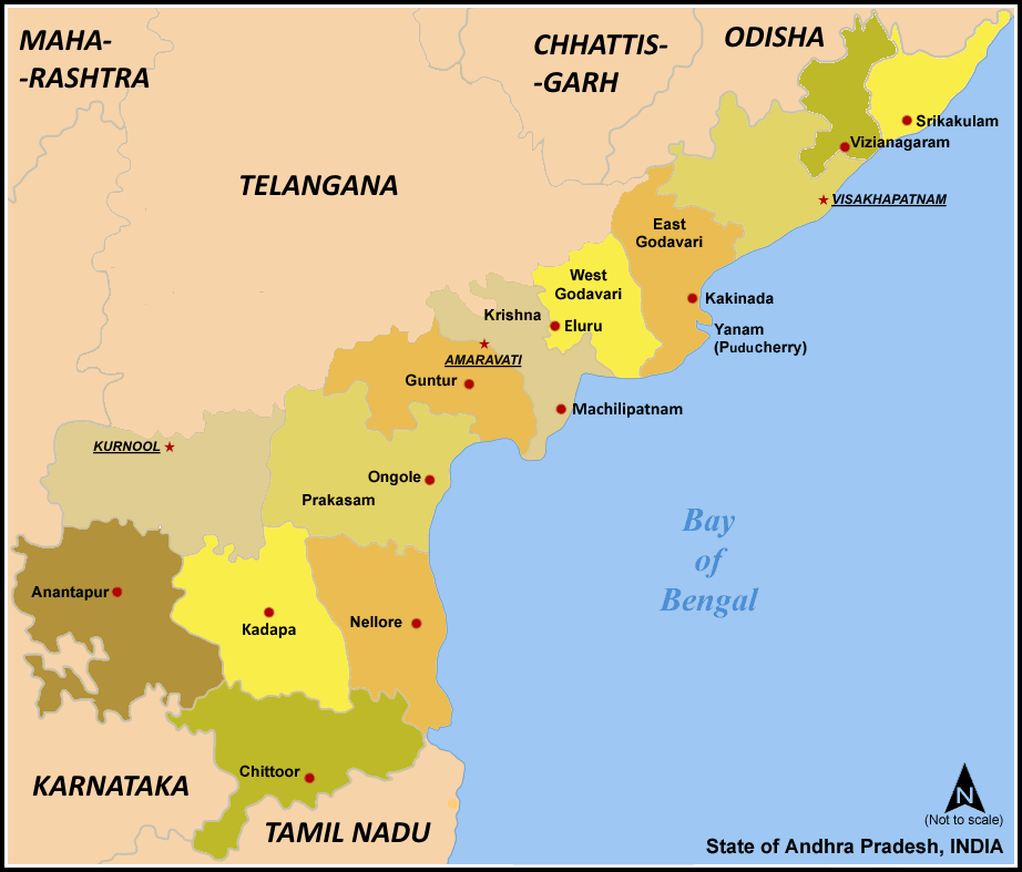
Image: Map AP dist all shaded
Size of this preview: 702 × 599 pixels. Other resolutions: 281 × 240 pixels | 922 × 787 pixels.
Original image (922 × 787 pixels, file size: 110 KB, MIME type: image/png)
Description: Map of w:Andhra Pradesh, India with district boundaries - add districts shaded.
Title: Map AP dist all shaded
Credit: No machine-readable source provided. Own work assumed (based on copyright claims).
Author: No machine-readable author provided. Miljoshi assumed (based on copyright claims).
Usage Terms: Creative Commons Attribution-Share Alike 3.0
License: CC-BY-SA-3.0
License Link: http://creativecommons.org/licenses/by-sa/3.0/
Attribution Required?: Yes
Image usage
The following page links to this image:

All content from Kiddle encyclopedia articles (including the article images and facts) can be freely used under Attribution-ShareAlike license, unless stated otherwise.